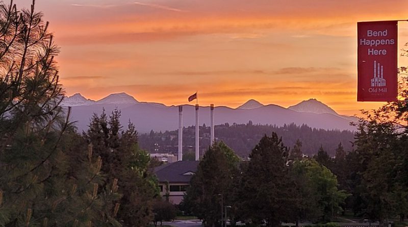
Savor the Beauty of Central Oregon
Tucked away in central Oregon, alongside the Deschutes River, sits one of the best destinations in the country for motorcycle riders. Bend Oregon.
A small mountain town with a population of just under 100,000, each of whom are as fiercely proud of their downtown brew pubs, restaurants, and art as they are their environmentally righteous beliefs. Bend even goes so far as to ask visitors to take a pledge that can be summed up as a promise to make environmentally smart decisions and to leave Bend a little better than before. Ok, nothing wrong there. But isn’t that just being a polite guest?
From Outpost to Popular Motorcyclist Destination
Bend started out as an informal, unsettled, waypoint for prospectors seeking gold in what later became known as the John Day Valley and for explorers hunting beaver pelts farther north. The surrounding green prairies and ample water from the Deschutes River also made the area ideal for farming and ranching. In the late 1800’s the still unnamed town took shape and ultimately was incorporated as Bend Oregon in 1904.
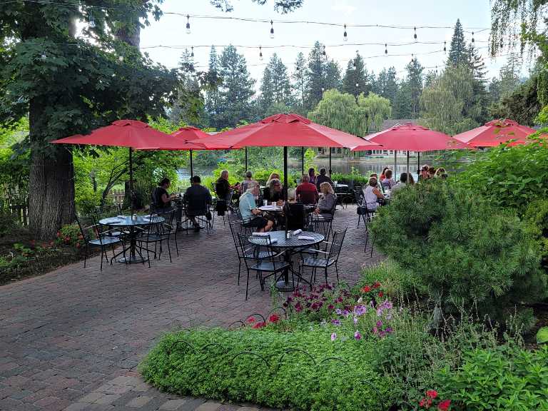
Today, the downtown core is a walkable and vibrant collection of restaurants, pubs, and comfortable hotels. Art galleries offer a taste of the city’s rugged outdoor heritage and make for no-cost evening entertainment. Restaurants run the gamut from inexpensive take out to elegant dining. For beer lovers, there are several good brew pubs to choose from. All conveniently within a pub crawl of each other. Try as many as you like, you won’t be disappointed. Bend hotels are scattered across the area, but only a few are within an easy walk of the downtown area. If you prefer to ride in and cover your bike for the evening, then consider the DoubleTree by Hilton on Franklin Ave. It is literally steps from the downtown core.
Getting to Bend
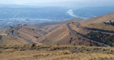
Given that Bend is more or less located in the center of Oregon, there are many good routes to get here. Our two favorites are either from Portland via The Dalles or from Seattle through eastern Washington.

The Portland route follows I-84 along the Columbia River, before turning south at The Dalles on US-197 to Bend. This is an easy 4 hour 215 mile ride with plenty of points to enjoy views of the mighty Columbia. To enjoy more views of the Columbia River, stay on I-84 for another 20 miles to Biggs Junction and then take US-97 to Bend. The difference in total riding time is less than 30 minutes.
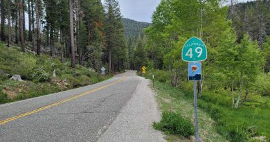
The route from Seattle takes I-90 over Snoqualmie Pass to Ellensburg where it picks up Canyon Road (SR-821), a not-to-be-missed twisty section of road through the Yakima River canyon that leads to Pomona. From there head to Yakima and follow US-97 to Biggs Junction a small Oregon town on the Columbia River. Gas up and then continue on US-97 through miles and miles of farming and ranching country on the way to Bend. The Seattle to Bend ride takes just over 6 hours to cover about 350 miles.
Riders coming from the south can take US-97 into Bend, perhaps starting the day in Reno. Getting to Bend from the east takes a little more thought about where to begin. Popular points of interest like Yellowstone or Jackson Hole, are over 10 hours riding time away putting them beyond a one day ride. But take a look at Twin Falls Idaho as a convenient overnight waypoint. The Perrine Bridge over the Snake River canyon is itself breathtaking and worth a stop. Even so, Bend is still a 7 hour ride from Twin Falls.
Rides in the Bend Area
All in all, Bend is an ideal place to spend a night or two while enjoying the incredible roads that stretch out in all directions. Keep in mind the elevation of Bend is over 3600 feet meaning late fall, winter, and early spring are cold and road conditions can be uncertain. The best riding is from late spring through the mid fall (roughly mid to late October). That said, it never hurts to check the weather forecast any time of year.
Deschutes Lakes Ride
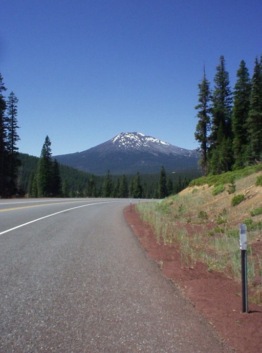
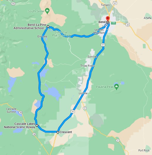
Take a ride through the Deschutes National Forest along the Cascade Lakes National Scenic Byway where it passes between Mount Bachelor and Broken Top mountain. Not surprisingly the two lane paved road is lined by forest, but broken up by regular clearings that expose views of the surrounding mountains including Broken Top and South Sister (the south-most of the Three Sisters peaks). As the ride continues past Bachelor the scenery changes to alpine lakes beginning with Devils Lake and continuing to Elk Lake and more beyond that.
This ride leaves Bend to the south and connects with the Cascade Lakes National Scenic Byway (OR-372). From there follow the scenic byway for about 80 miles before turning left on Crescent Cutoff Road heading back to US-97 and then north back to Bend. All told the ride covers about 125 miles and can take a little less than 3 hours without stops.

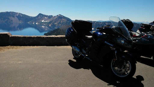
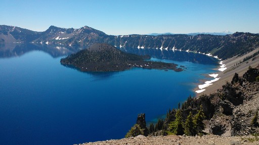
Crater Lake National Park
If the ride through the Deschutes National Forest seems too short, then consider riding farther south to Crater Lake National Park. Instead of turning north back to Bend on US-97, turn south. Roughly 75 miles down the highway, at Diamond Lake Junction, take OR-138 toward the Crater Lake North Entrance. Follow the North Entrance road to the Park and take West Rim Road toward the Crater Lake Lodge.
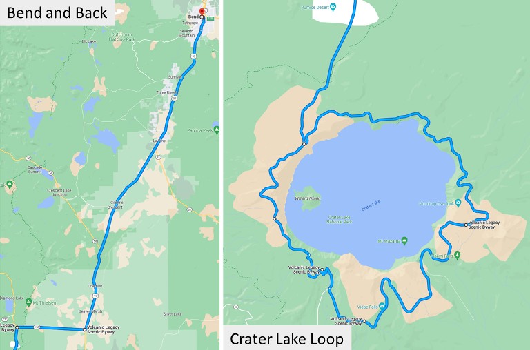
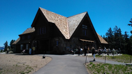
A stop at Crater Lake Lodge is worth the time. Full service amenities are available. Views of the lake from the back patio bring home the point that this is in fact a volcanic crater.
Leave the lodge continuing along West Rim Drive to the east where the road becomes East Rim Drive. Eventually East Rim Drive connects with the North Entrance Road. Follow the North Entrance Road back to OR-138 and then US-97 to Bend.
Extending the Deschutes Lakes ride to include Crater Lake adds 135 miles and 3 hours of riding time, making the full day a 260 mile, roughly 6 hour riding adventure.
The John Day Loop
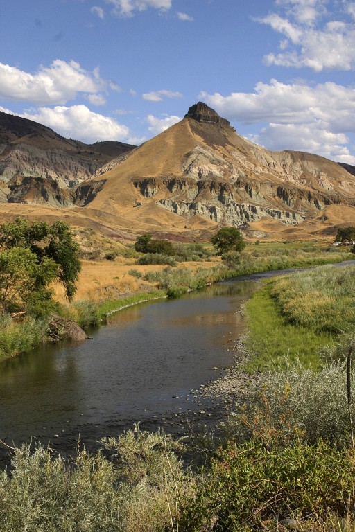
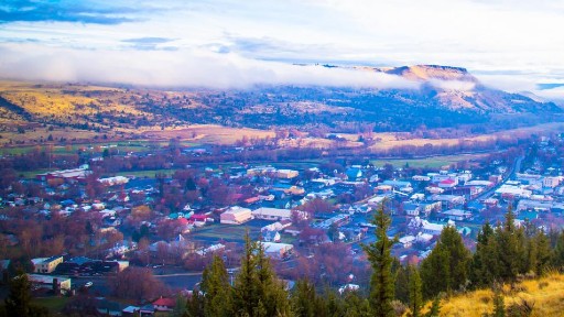
John Day is a friendly little town of about 2000 residents in eastern Oregon. The town itself has a mix of restaurants, plenty of gas stations, and a few hotels making it a suitable place for an overnight stop. But this ride begins and ends in Bend, so for our purposes John Day marks the eastern most point of the loop perfect for lunch and gas before turning around for the ride back.
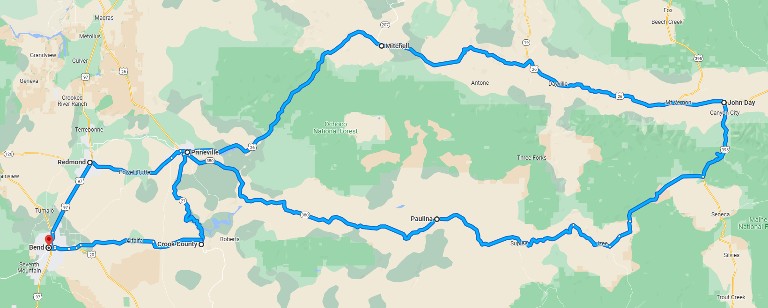
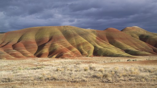
The route itself is a loop one can ride clockwise or counterclockwise. Assuming a clockwise loop, leave Bend toward Prineville to the east. From there follow US-26 east. The highway passes through the Ochoco National Forest on the way to John Day. Keep an eye out for the John Day Fossil Beds National Monument. More like a national park than a monument, the Painted Hills, many walking trails, and visitor center are another perfect example of what makes riding America so extraordinary. Ride through the town of John Day, grab lunch at a restaurant, gas-up and get ready for the return ride.
Continuing in a clockwise loop, the ride back to Bend starts on US-395, then takes a right westbound on County Highway 63 also known as the Izee Road to Bush Ranch Road. The road name will change a few times along the way, eventually turning into Highway 67 and then the Paulina Suplee Highway. Names aside, the road leads into Prineville and from there it’s an easy ride into Bend.
Without stops the John Day Loop ride runs a little more than 325 miles and about 6 hours of riding time. An early start on a summer day allows plenty of time for a stop at the Fossil Beds National Monument.
Central Oregon – A Ride You’ll Remember
Central Oregon doesn’t get as much credit among motorcyclists as it should for having some of the best riding in the country. Bend makes an ideal destination and a comfortable base camp to explore the area. We’ve described rides to a couple of the better known destinations. But the surrounding five national forests, rivers, valleys, and wide open prairies leave a lot of territory for you to discover on your own.


Did we hit the mark?
Click the Thumbs Up or Thumbs Down button to email your feedback.
Your questions and comments help improve American Sport Touring. Your email is not used for any other purpose. Please read our Privacy Policy.